

RUDN University Ecologists Find a Flaw in Arable Soil Organic Matter Detection Using Optical Remote Sensing Data
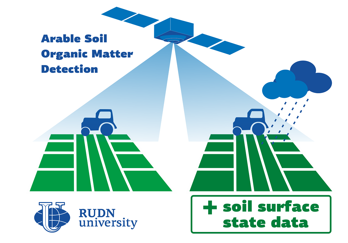
One of the main characteristics of the soil is the content of organic matter (SOM) in it. There are many ways to measure it, one of them is SOM modelling based on the optical properties of the soil with data from satellites for example. There are several known disadvantages of this approach., When the soil is wet after raining its optical properties change, so the accuracy of determination decreases. RUDN University ecologists have shown that rain also transforms the top layer of soil, causing a change in its properties. This, in turn, affects the accuracy of determining the content of organic matter.
“Most studies using optical satellite data or field spectral reflectance data to map SOM content are based only on a single date, and they do not register the soil surface state at the time of spectral data acquisition. However, the extent to which the soil surface transformed by rainfall provides information on the properties of the arable horizon is not yet clear. This discrepancy is one of the main reasons why models obtained in the laboratory fail in usage when applied to field measurements. It also limits the reproducibility of models predicting the SOM content based on satellite data. The aim of the research was to study the impact of rainfall-induced soil surface spectral changes, in particular, the formation of soil crust, on the accuracy of SOM content mapping based on optical remote sensing data”, said the associate professor of the Department of Rational Nature Management of the RUDN University.
Ecologists studied an arable field in the Tula region (Russia) with an area of 13.5 hectares with the grey forest type of soil. At the time of the study, the field was fallow (nothing was grown on it). The ecologists collected 30 samples of the topsoil from the field (up to 5 cm deep) and determined the content of organic matter in them using the Tyurin method based on the oxidation of soil organic matter. The optical properties of the soil were measured using a HandHeld-2 spectroradiometer. Data from Sentinel-2 remote sensing satellites were also used for 5 survey periods from April to August.
After analyzing the data, ecologists have shown that changes in the surface of arable soils induced by precipitation reduce the accuracy of calculating SOM by optical properties. The proximity of calculations to the real value varies from 67% to 72% depending on the amount of precipitation. Then the researchers added the data about the soil crust area (compacted upper microlayer of soil with “clogged” pores due to rain) and an indicator that takes into account the area of shadows and/or cracks on the soil surface. The accuracy increased up to 84%. The ecologists concluded that SOM calculation models based on satellite data need to be supplemented with information about the state of the soil at the time of data acquisition.
“The impact of rainfall leads to a discrepancy in the spectral reflectance and properties between the soil surface microlayer and the rest of the ploughed horizon. Our study showed that this rainfall-driven discrepancy negatively affects the accuracy and quality of models developed to map SOM content from Sentinel-2 data. The incorporation of information on the soil surface state in the model allowed the compensation of negative rainfall impact and the development of stable models with higher quality and accuracy. Accounting for the rainfall-induced changes in the soil surface is necessary to ensure the reproducibility of the developed models and the correct assessment of organic matter in the soil ploughed layer”, said the associate professor of the Department of Rational Nature Management of the RUDN University.
The results are published in the Remote Sensing.
In the last five years, academic staff of RUDN alongside the Chinese universities and research centers has achieved impressive results. More than 1,000 scientific publications were made jointly in a wide spectrum from engineering and technology to medicine and social sciences. 19 of these materials were published in top-rated journals which verifies that the works were world-class level.
RUDN University has been included among the leaders in the BRICS ESG University Ranking among 65 leading universities. They were assessed on 20 criteria, ranging from education and research to environmental and social agendas.
At a meeting of the new RUDN University Dissertation Council in the specialties of 2.1.12 “Architecture of Buildings and Structures. Creative Concepts of Architectural Activity” and 2.1.11 “Theory and History of Architecture, Restoration and Reconstruction of Historical and Architectural Heritage”, three postgraduate students — Natalia Kalinina, Evgeny Ogienko, and Yulia Loginova — were awarded PhD degrees in Architecture for the first time in the university's history.